One of my ongoing research projects, and the subject of my next book, looks at the history of Abbot Augustus Low’s Horse Shoe Forestry Company maple sugaring operation in New York’s Adirondack wilderness. Low was a very wealthy New Yorker who at the end of the nineteenth century established an extensive maple operation and associated townsite, mills, dams, and private great camp, all connected by his own personal railroad in the wilderness of the Adirondacks.

As a part of this research I have been conducting extensive field investigations searching for and mapping the physical remains associated with Low’s maple operations. While there is much to tell, and will be told when my book is finished, here is a small taste of what has been found and how.
Many folks with an interest in Adirondack history and maple sugaring history are familiar with an album from 1901 of hand-colored, unlabeled, photographs taken by George Baldwin titled Adirondack Sugar Bushes – Horseshoe – St. Lawrence Co., N.Y. These photographs and album were commissioned by Low and the Horse Shoe Forestry Company. There is only one known version of this album which is kept in the collections of the Adirondack Experience, a museum dedicated to Adirondack history in Blue Mountain Lake, NY. What is not as well known, is that there is another set of the same images in non-colorized form that were submitted for copyright purposes and are now held in the Library of Congress (LOC) in Washington, D.C. As a part of the copyright process, the images were published in the 1901 Copyright Office of the Library of Congress – Catalogue of Titles Entries of Books and Other Items, each with corresponding numbers and titles. What is helpful is that the set of images that are now found in the LOC, which I examined in the fall of 2018, all have their original numbers printed on them so one can see what were the actual titles assigned to these images in 1901 by A. A. Low.
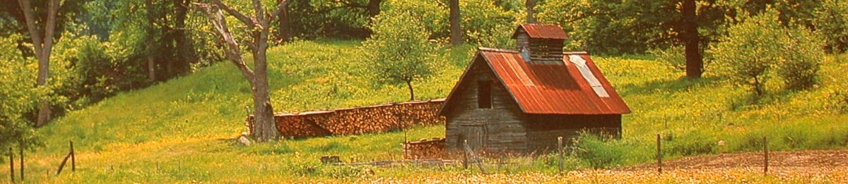
Through a variety of historical and archival references and reports, we know the Horse Shoe Forestry Company built three large buildings for processing maple sap, each containing five enormous Champion Evaporators made by the G.H. Grimm Company. While these were referred to as sugar houses, they were more like maple syrup factories or plants, operating on a scale not before seen in the maple industry. All three of the large plants are featured in images in the colorized album, but I will focus on one of these plants for this particular part of the Horse Shoe story.

This particular image, LOC copyright number 1690, was titled “Maple Valley Sugar House.” For those familiar with the various images and maple sugaring buildings that once stood at Horse Shoe, that title might cause some confusion. There is another, better-known, syrup plant, also called the Maple Valley Sugar House, show in the figure below. The LOC title for the better-known sugar house is also labeled “Maple Valley Sugar House,” and has been assigned LOC number 1689. For the sake of clarity, I will call these Maple Valley 1 (image 1689) and Maple Valley 2 (image 1690).

Maple Valley 1 was the showcase sugar house in Low’s maple operation, and the archaeological remains of it are still fairly well preserved, if one knows where to look. Other researchers in the past, such as railroad historian Michael Kudish, have identified and published the location of Maple Valley 1. However, the true location of Maple Valley 2 has been unknown. One of the goals of my fieldwork in this Horse Shoe Forestry Company maple history project has been to identify all the locations of the buildings associated with the maple sugaring operation.
To that end, archival research in the collections at the Adirondack Experience (AE) led to the surprise discovery of another set of previously unknown images taken by photographer George Baldwin as a part of the same sugarbush series of the popular colorized album. These images, which had not been previously digitized and widely shared, brought to light a number of new and interesting details.

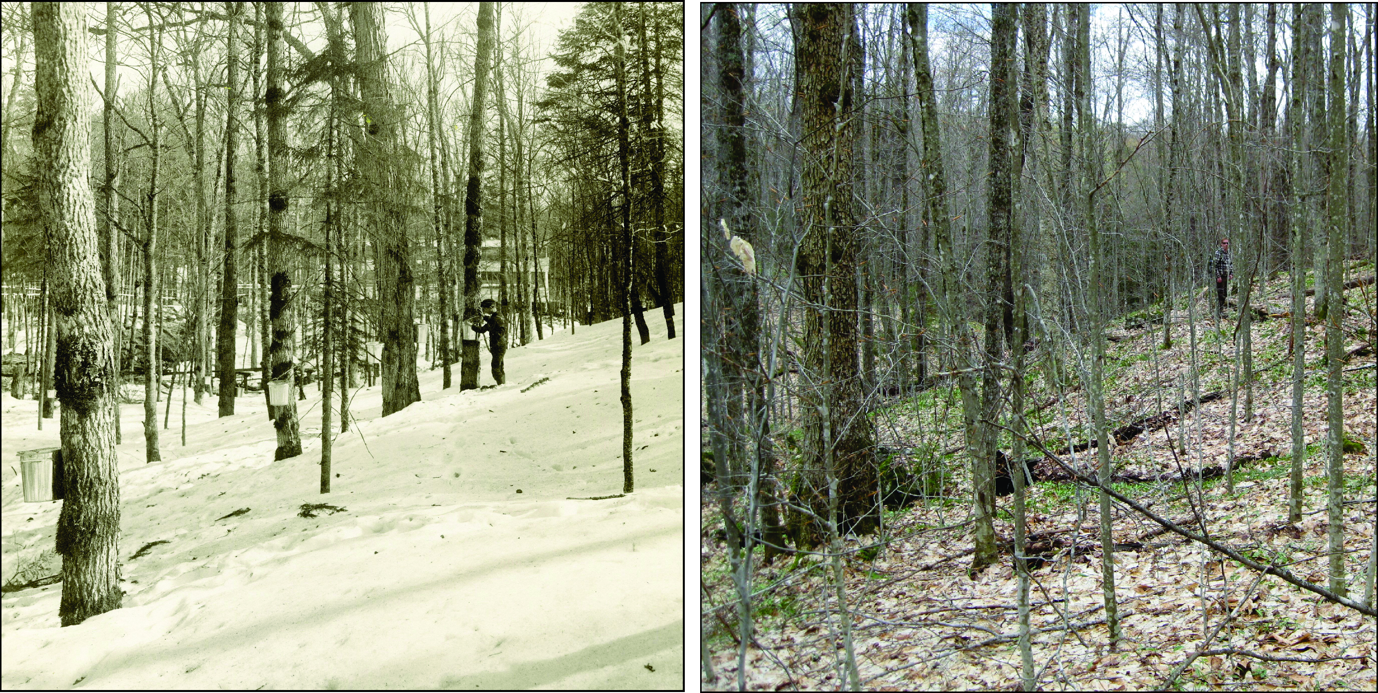
In an attempt to shed light on the location of the Maple Valley 2 sugar house, the following image was especially important. In the image we see a boy tending to a sap collection pail on a hillside. But if one zooms in to what is in the background through the trees, we can clearly see the Maple Valley 2 Sugar House. Wowza! You can also see in the image the many elevated sap pipelines running through the trees downslope carrying sap from the sugarbush to the sugar house. These pipelines are very evident in the LOC image 1690. What is particularly notable in the full image of the boy on the hillside is the contour of the landscape in the immediate foreground as well as the land contours to the left of the image across the drainage and the flatter and much more open space surrounding the sugar house in the background.

Finding a place in the landscape that fit location was key to identifying where this image was taken and where the Maple Valley 2 sugar house once stood. In thinking this through and studying the landscape settings that had potential, an initial question was where exactly to start. Conventional wisdom has been that there were three branches to Low’s railroad each with their own names, Wake Robin Railroad, Maple Valley Railroad, and Grasse River Railroad, and we known there were three large sugar houses. Logic would have it that one branch of each railroad went to each of the large sugar houses. But was that true and what was the evidence to support or counter that notion? Well, the evidence from the LOC labels were that the three large sugar houses were named Wake Robin, Maple Valley 1, and Maple Valley 2. That would suggest that one of the large sugar houses was not associated with the Grasse River railroad branch. So, instead of looking in the vicinity of the Grasse River drainage, maybe one should start looking for a location for Maple Valley 2 in a place that was connected to the Maple Valley locale.
After studying topographic maps of the area, air photos from the 1940s to the present, and historic maps that show roads and railroad grades that connect to Maple Valley, I settled on a few possibilities and put them to the test. Could I find the spot where that photo was taken of the boy at the tree with the Maple Valley 2 plant in the background? After a bit of tromping up and down a few drainages, valleys, and hillsides, I think I found the spot!

To the left is a modern view taken in early May 2019 that attempts to represent the same location and vantage point as Baldwin’s 1901 hillside photo (AE image P015527). As a stand-in for the boy in the original image is Adirondack trail expert and local history buff Bill Hill, who accompanied me in the field that day. If you are not familiar with Bill’s work you should check out his blog and new book Hiking the Trail to Yesterday for great information on enjoying historical places in the Adirondacks on foot or with paddle.

And here is the original and the recent, image side-by-side in a repeat photography format. I like what I see, with the angle of the slope, the contours on the far side of the drainage, and the flat valley below, which is now much more grown up with mature spruce and maple.
If this gets us to the right location for the Maple Valley 2 sugar house, which I think it does, then we are left with the next question. What remains of the Maple Valley 2 sugar house, if any, are left on the flat ground in the valley below? And that part of the story I will leave to be told in the book.
Another well penned, and interesting piece. I can’t wait to see the finished book.